Viewing entries tagged
Mt Shasta

Comment

Celebrating 50 Years On Earth!

My perception of what 50 looked like was very different than how I actually felt when I turned a half century old. I don’t feel 50, but back in 2021, my golden birthday was upon me and I couldn’t think of a better place to celebrate this milestone than in California where I have lived most of my life!

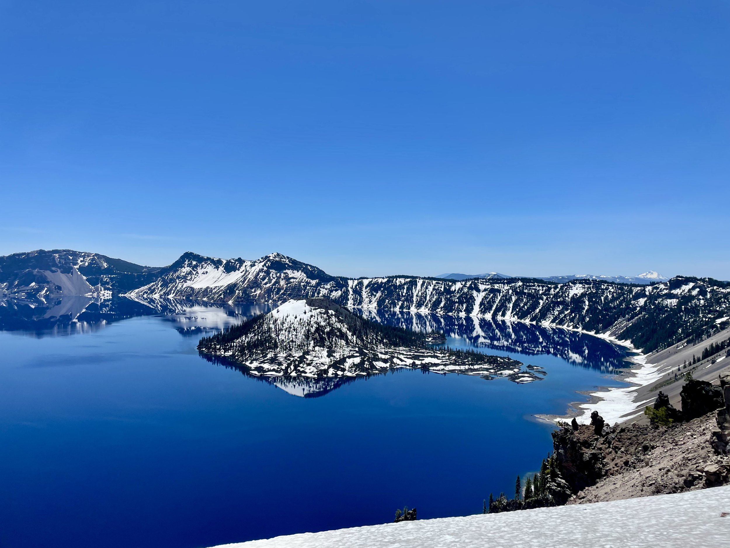
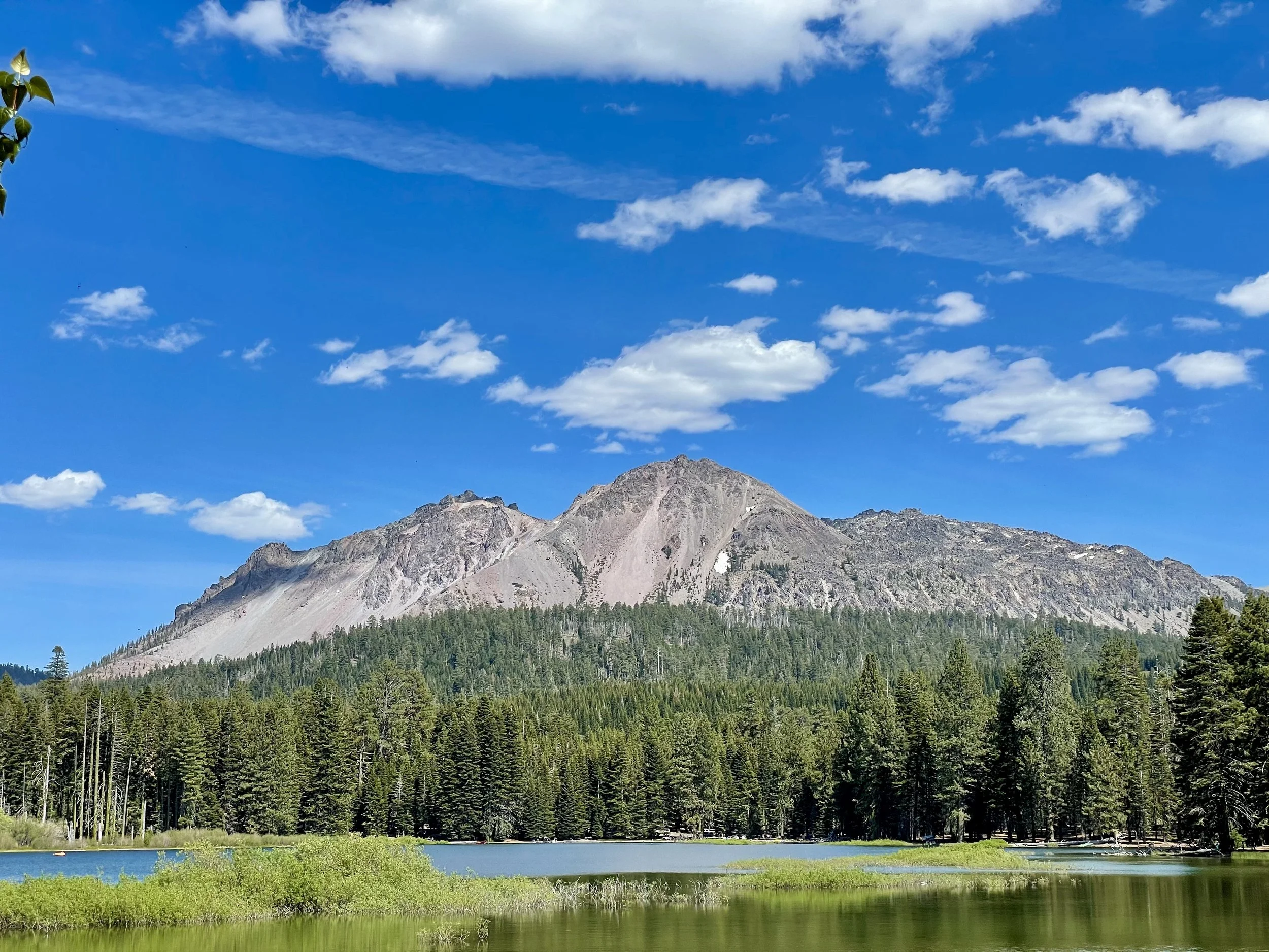
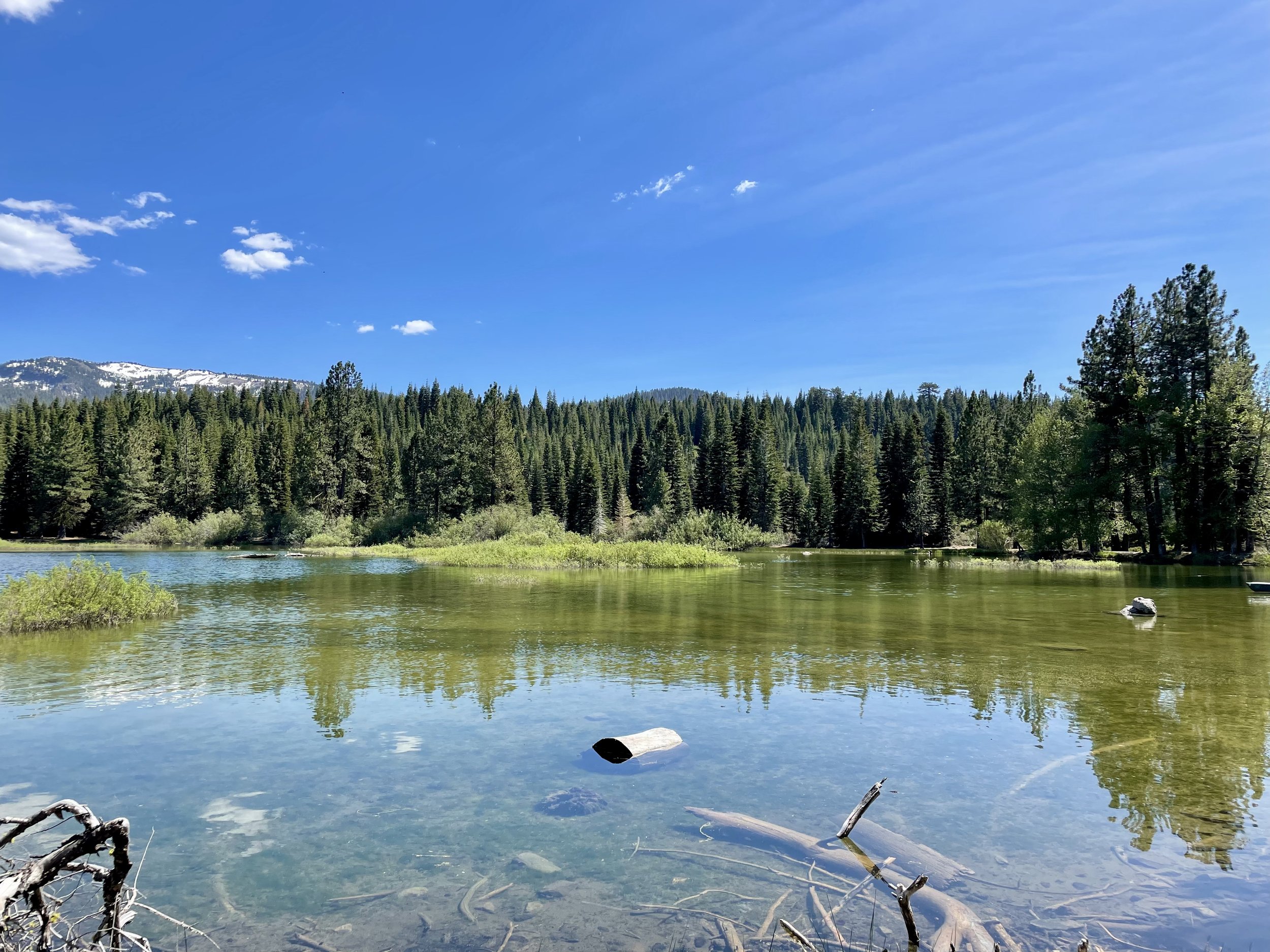
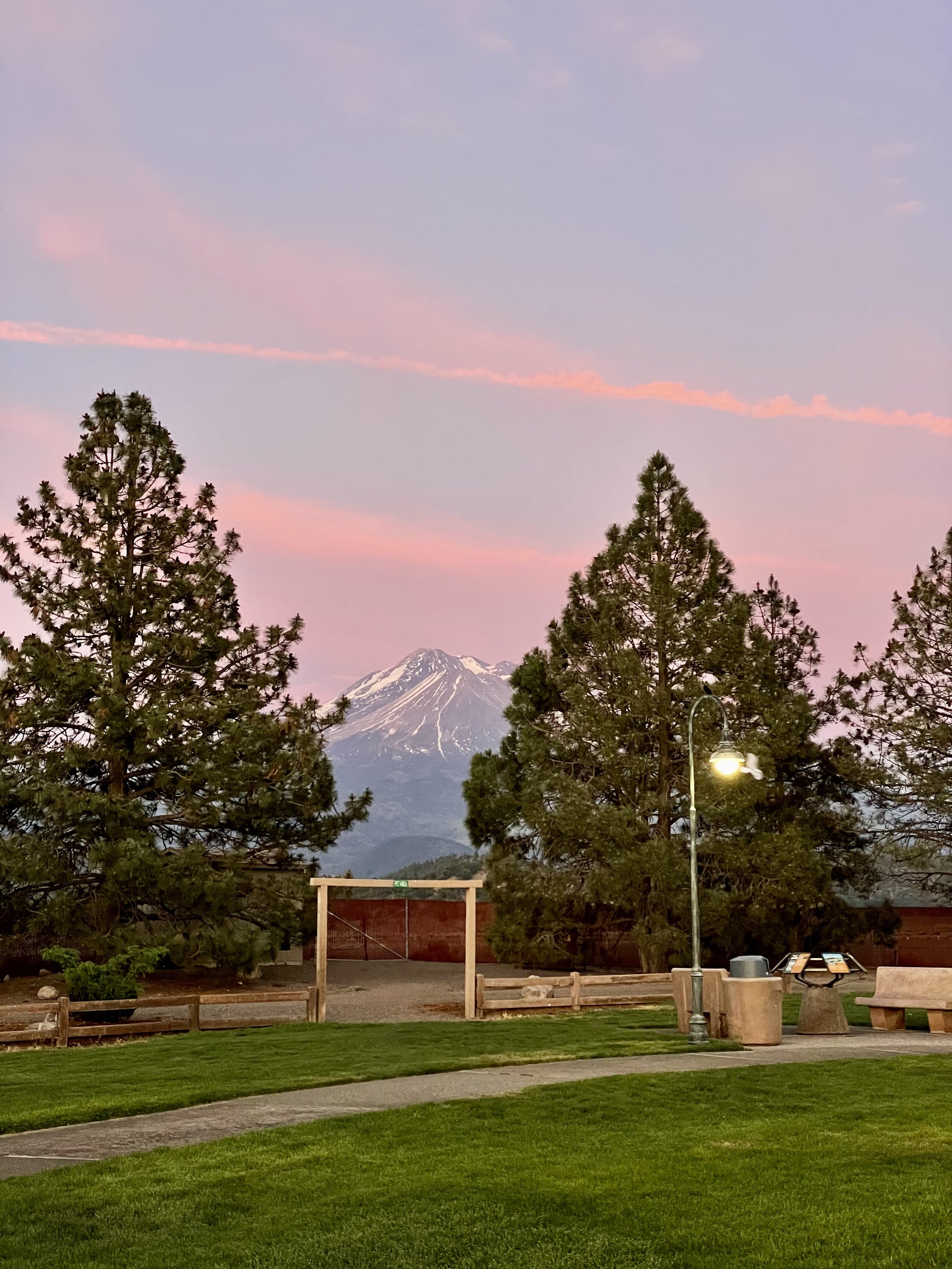
My San Jose Besties and I, known by the moniker “DEJA B” (based on our first name initials), have been going camping together at Pinecrest Lake every summer for over a decade. In 2021, it just turned out that our camping trip was right before my birthday, making it an ideal time for a road trip to see my friends and then celebrate in the Bay Area after. My trip began on June 19th as I headed south along I-5 to Oregon. It was a beautiful sunny day with clear skies and I ended up near Lebanon to see my cool friend Kim for the night. It’s always convenient to have a safe overnight spot and luckily I have a few great friends along the way that I usually stop at. The next morning I continued on south into California, passing Weed and Mount Shasta, and ending up in Chico at my friends Julie and Eric’s house for the night. Continuing on the next morning, I stopped in Marysville for lunch along Ellis Lake and let Maverick explore a bit and watch the ducks. Then my journey south took me passed Copperopolis and Lake Tulloch and finally ending up in Pinecrest at our campsite in the early evening.

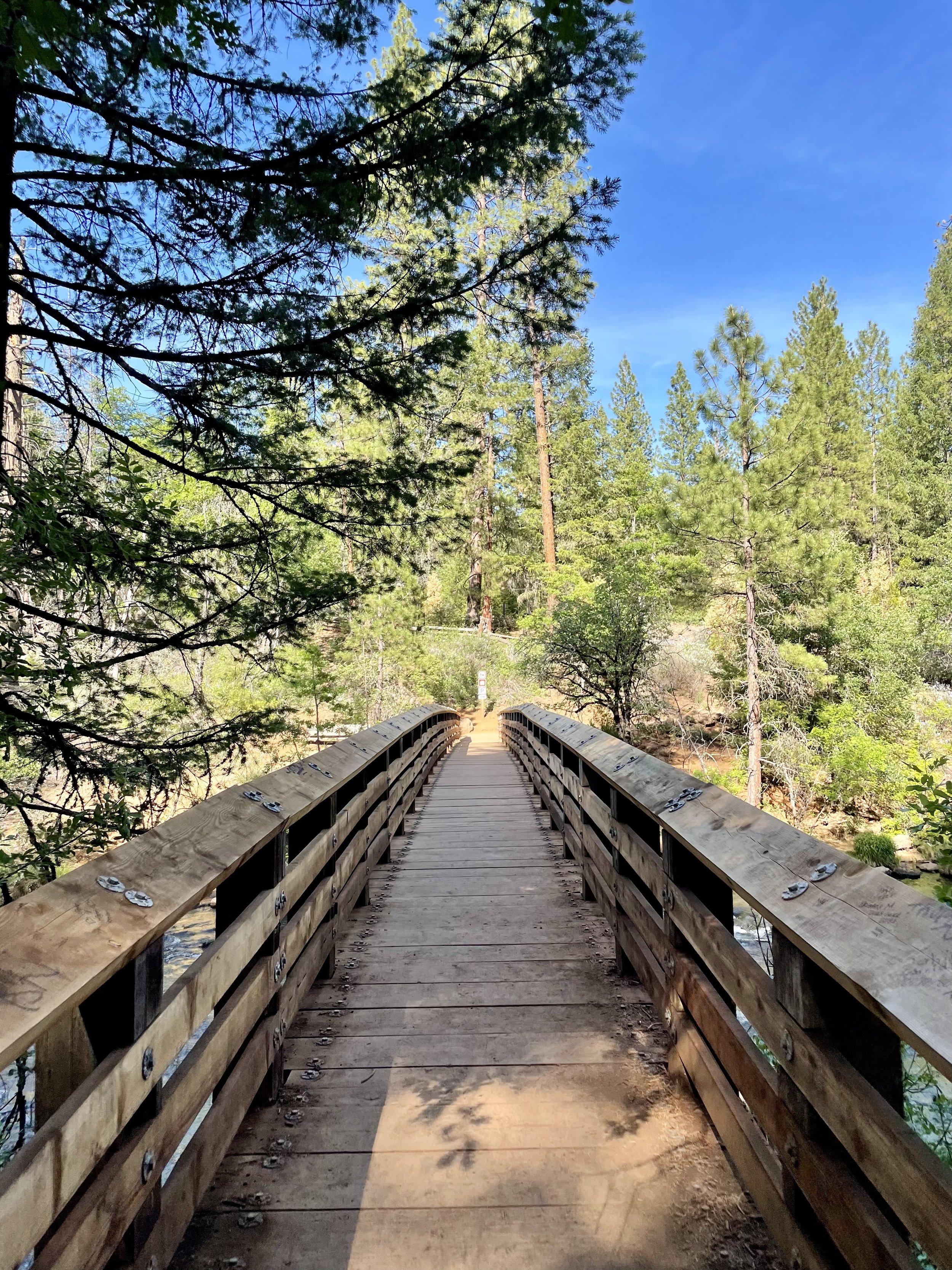
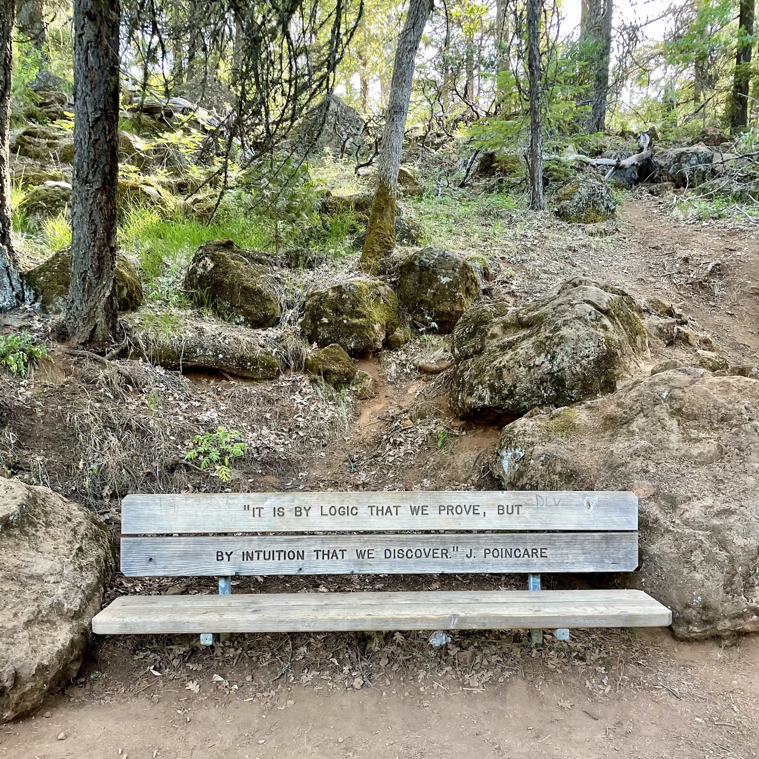
We camped for six days in the forested campgrounds right by the lake and enjoyed our daily swims and campfires. Since there’s no data service at Pinecrest, I drove up to Dodge Ridge every few days to get some things done on my phone while Maverick explored the rocks. My hiking in Washington for a few months prepared me to hike the Pinecrest Lake Loop, which is almost 4 miles around. Check out my Instagram Reel from that hiking adventure to get an idea of what the trail is like. It was a hot day, so I was a bit drained at the end of the hike, but it was totally worth it! My besties had a small 50th celebration for me the last night with lots of decorations and a “50 Looks Good On Me” sash. I had a great time celebrating with these lovely ladies who have been my besties for over a decade!

Following our camping adventure, I visited Yosemite for the day and then made it back to my old stomping grounds in San Jose. On my actual birthday July 2, my bestie Joanna hosted a pool party at her house for the extended DEJAB group, which was an absolute blast! Then the following day, my lifelong friend Barbara (yes we have the same name & are both Swiss), whom I’ve known since I was 5 years old, offered up her incredible property for my Big 50 Birthday Party, which was super sweet of her. Around 30 of my favorite people showed up to celebrate with me for the evening with a taco truck and lots of wine! It was so good to see everyone and spend time with them catching up on life events. I even had one of my Clubhouse friends named Max show up, whom I hadn’t met in person before, as well as some vanlife friends whom I met a few months earlier! It was a bittersweet goodbye at the end because I knew I wouldn’t see many of these people for a long time since I don’t live in the Bay Area anymore.

After the birthday festivities, I headed to Clearlake to celebrate 4th of July with the Chesterman Family, more dear friends of mine whom I have a long history with. They have a lovely lakehouse in Lakeport and we celebrated Independence Day with boat rides during the day and fireworks at night! I realized I didn’t take any photos of the group, so this is all I have to share with you from that patriotic day.

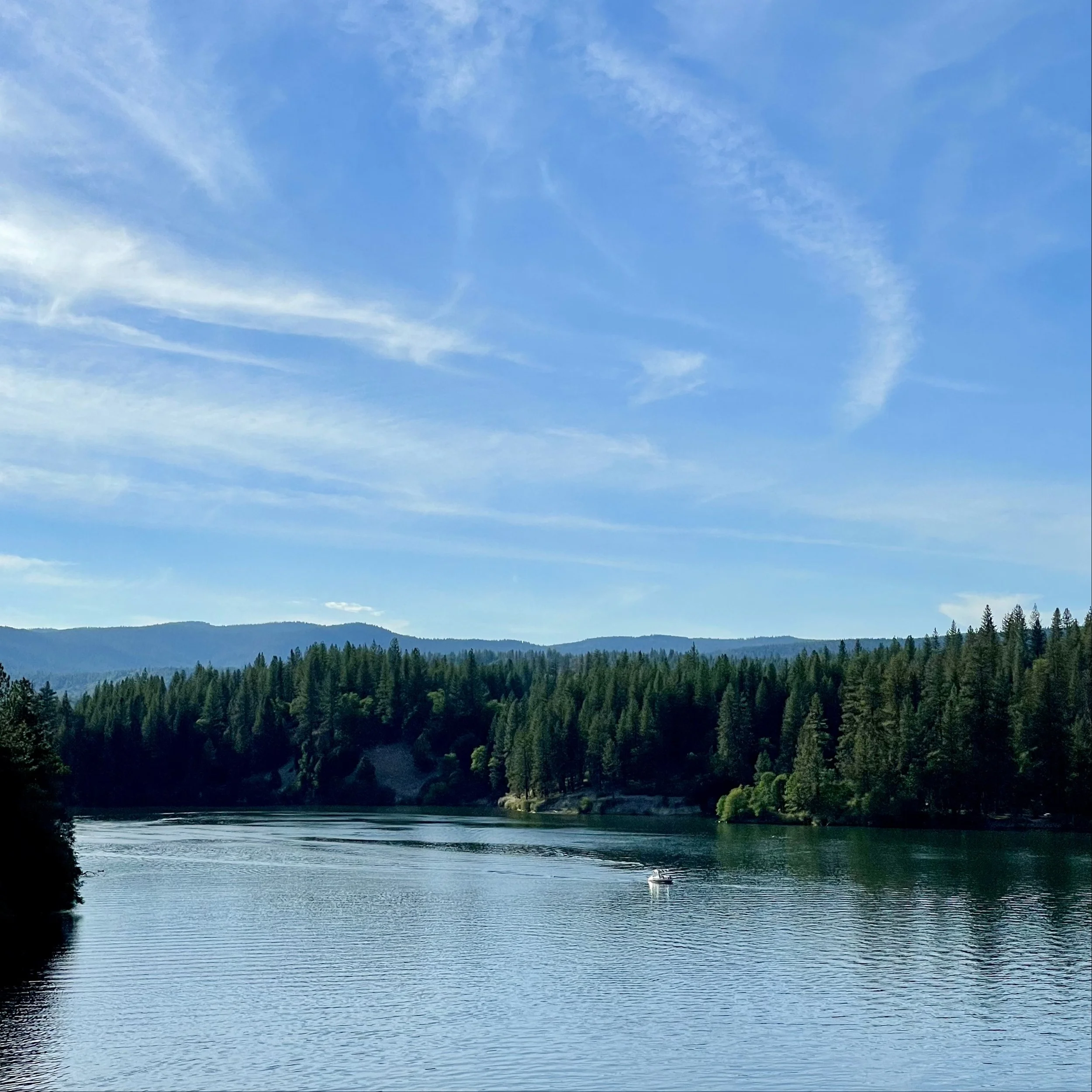
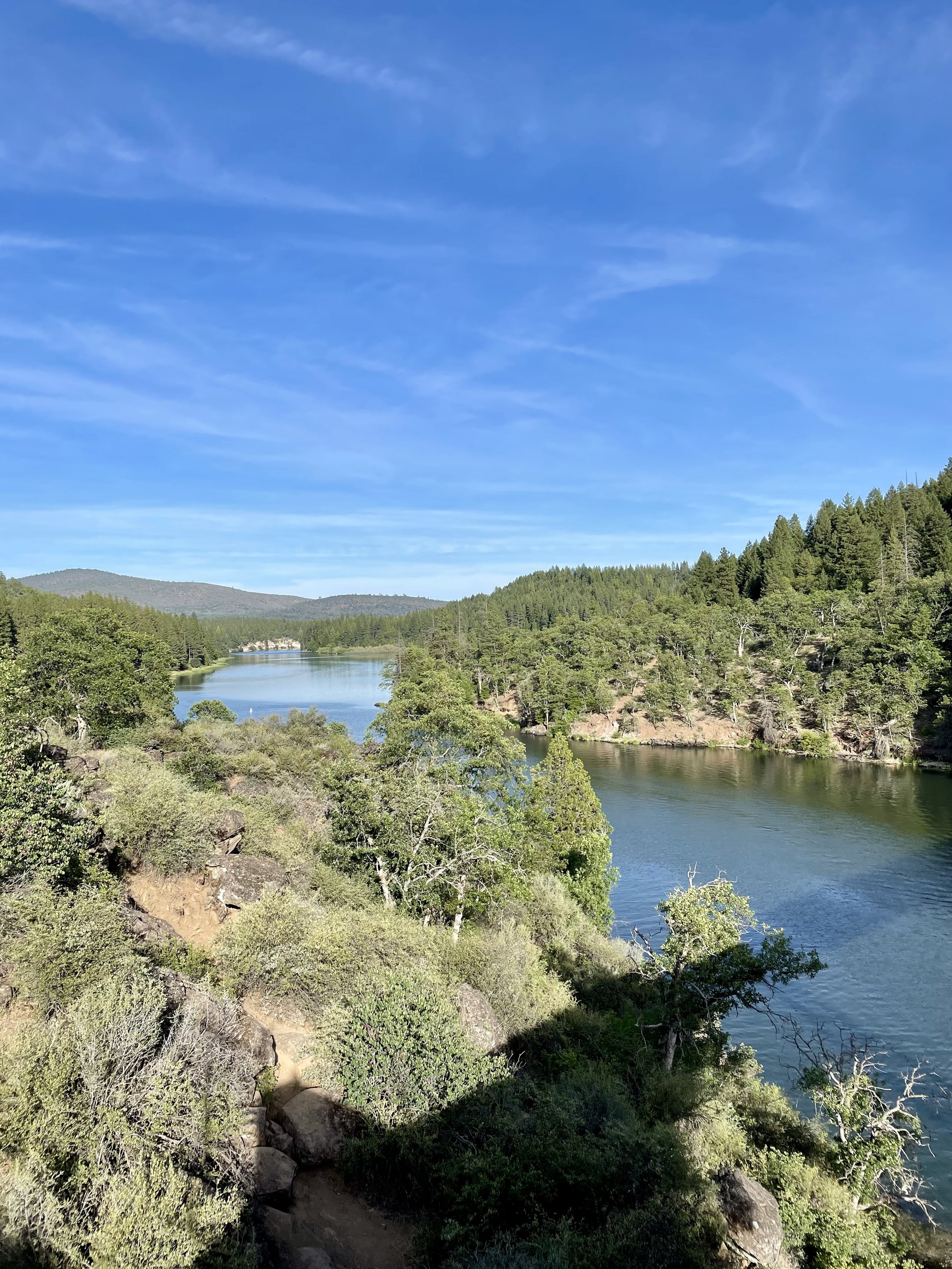
I headed north the following day to Cottonwood, where Rebecca and Ed live, friends and neighbors through yoga class from a few years before I moved. I spent the day and night with them at their new place along the Sacramento River learning all about how they ended up living at Lake California and how they are adjusting to their move. I sadly didn’t take any photos of us but I did get a few good sunset shots.

As you can see, I am lucky to have a lot of wonderful friends that I can visit and stay with whenever I travel from Washington to California, many of which are conveniently located off major routes I take to get around. My 50th was a highly memorable birthday and this road trip really allowed me to spend time with most of the people that I proudly call friends and love my with my heart!

Comment

Comment

The Incredible Beauty Of Crater Lake

Following my day exploring Lassen and Burney Falls, I left Northern California and headed into Oregon. I decided to check out Crater Lake National Park, which I had only been to once before in 2016 for a brief visit. Formed nearly 8,000 years ago, Crater Lake sits atop Mount Mazama, part of the Cascade Range spanning northern California to southern British Columbia. Mount Mazama’s eruption about 5700 B.C. catapulted volcanic ash miles into the sky and expelled so much pumice and ash that the summit soon collapsed, creating a huge, smoldering caldera. Eventually, rain and snowmelt accumulated in the caldera, forming a lake more than 1,900 feet deep, making it the deepest in the United States. There are many activities one can do around Crater Lake depending on the season. Hiking, backpacking, camping, picnicking and sight seeing are popular pursuits within the park, though there is limited access from October to June. Boating and scenic driving around Rim Drive can be enjoyed by visitors during the summer months. In winter snowshoeing and cross-country skiing provide solitude and a little-known view of the park.

There was still a lot of snow when I arrived on June 1, 2021, therefore, only the West Rim was open while the East Rim was still closed. Since I drove in from the South Entrance, I first stopped along Annie Creek Canyon viewpoints and learned all about fossilized steam events that sculpted the rocky spires in this river valley. Once I arrived at the rim, I stopped at Rim Village and did the self-guided walking tour along the snowy path to admire this incredibly blue, mirror-like lake. I wasn’t prepared for all the snow, but I still trekked through some big piles of snow to get to all the various vista points to soak in the wonderful views. Did you know that Crater Lake is so blue because longer wavelengths of sunlight (red, yellow, and green) are absorbed by water while blue light is not absorbed well? Blue strikes the water and is scattered and redirected back from the lake depths to our eyes. Crater Lake is also known for its unique clarity and purity because it’s only filled with rain and snow melt, no streams empty into it which usually bring the sediments that turn waters cloudy. I also learned about Samuel T. Mather from a commemorative plaque along the rim since “he laid the foundation of the national park service, defining and establishing the policies under which its areas shall be developed and conserved unimpaired for future generations.”

Next, I headed to the Discovery Point Overlook, where gold prospector John Wesley Hillman, who was actually looking for Lost Creek Mine, first spotted Crater Lake in 1853, calling it “Deep Blue Lake.” I also made some stops on the non-lake side of Rim Drive to see the volcanoes and mountains in the distance. I believe they are Mount Shasta, Mount Thielsen, Diamond Peak, Union Peak, and some others in the photos below.

I continued north to Watchman Overlook, another wonderful spot to stop to see a slightly different angle of the lake, though sadly the trail to Watchman Lookout was closed, as most trails were due to the snow. You pass very close to Hillman Peak around this part of Rim Drive, the highest peak on the caldera rim and the second-highest peak in the park. My last stop was Merriam Point Overlook near North Junction where you have the closest view of Wizard Island, which some call the most interesting feature on Crater Lake. It’s also the perfect place to see Llao Rock, Garfield Peak, Mount McLoughlin, and Mount Scott, who’s summit is the highest point in the park. While I was there in 2021, the Bronze Relief Map had not yet been erected at this overlook, but visitors now get to see this tactile map to enhance learning and understanding of the scope of the park and the depth of the lake, especially for kinesthetic learners and people with visual impairments.

Following the cataclysmic caldera-forming eruption of Mount Mazama, which left a hole about 4,000 feet (1,200 m) deep where the mountain had once stood, a series of smaller eruptions over the next several hundred years formed several cinder cones on the caldera floor. The highest of these cones, the only one to rise above the current lake level, is Wizard Island, which rises over 2,700 feet (820 m) above the lowest point on the caldera floor and the deepest point in the lake. One day I really want to experience the Wizard Island Boat Tour and see this 763-foot cinder cone up close. While on Wizard Island, you can hike the 2.2-mile roundtrip Wizard Island Summit Trail which has a path leading to the 90-foot deep crater at the summit. The hardest part of this journey is that you need to hike the Cleetwood Cove Trail to get down to the boat dock, which is very steep and strenuous as it drops approximately 700 feet in 1.1 miles and can take 30-45 minutes to descend, and then you have to hike it back up at the end of the day when you must ascend the 11% grade back to Rim Drive (comparable to climbing 65 flights of stairs). It’s a full day’s trip, but I’m sure it is worth it!

As most of my friends know, I’m 100% a water person and love being in, on, or around water as often as possible. The idea of swimming in Crater Lake sounds beyond amazing to the mermaid inside me and some day I hope to accomplish this feat and tackle that steep hike so that I can jump in. I’ve heard that swimming in the crystal blue waters is quite refreshing on a hot day, though during summer the average surface temperature of the lake is only 57 degrees F (14 degrees C). If you ever decide to make the trek down to the water, be sure to follow the rules as only bathing suits and basic clothing may be worn in the water to protect the clarity of the lake and decrease the possibility of introducing invasive species. Do NOT bring or use scuba and snorkeling gear, wet suits, masks, goggles, fins, inner tubes or any towable devices, kayaks, canoes, paddle boards and any motorized or non-motorized boats, inflatable rafts, flotation devices, personal life jackets or vests, nor waders. The park also recommends to have warm, dry clothing available to immediately put on after being in the lake. Swimming is only allowed within 100 yards of Cleetwood Cove and within 100 yards of Wizard Island, provided that swimmers remain at least 50 feet away from any boat, boat dock or buoy. Doesn’t this photo just beg you to jump in!!!

After my time at Crater Lake, I continued my trip through Oregon on my way home. Up next is the waterfall hikes I did in the Umpqua National Forest!

Comment

Comment

Lassen Volcanic Park, Manzanita Lake & Burney Falls

After my time at Descend on Lost Sierra, I headed north to Lassen Volcanic National Park on May 31, 2021. Did you know that Lassen Peak is the largest plug dome volcano in the world and the southernmost volcano in the Cascade Range? Lassen Volcanic National Park is also one of the few areas in the world where all four types of volcano can be found—plug dome, shield, cinder cone, and stratovolcano.

I enjoyed the drive through the volcanic landscape with hopes that I could hike the Bumpass Hell Trailhead and witness the largest hydrothermal area in the park. Sadly the trail was still closed due to the snow, making this the 2nd time I haven’t had the pleasure of seeing the 16 acres of boiling springs and mud pots, hissing steam vents, and roaring fumaroles up close! The first time I came to Lassen in 2018, this 3-mile roundtrip trail was closed for maintenance, so it looks like I’ll have to come back to Lassen again to conquer this trail and see the volcanic activity from the new boardwalks.

As you drive through this amazing national park from the Southwest entrance to Northwest entrance, you get stunning views of Mt Diller, Brokeoff Mountain, Eagle Peak, and Mt Lassen, as well as Reading Peak and Hat Mountain. The snow on the ground and the blue sky with some puffy clouds made for a great background really capturing the beauty of all these incredible peaks! I made it a point to stop at Emerald Lake and Lake Helen at the base of Lassen since these two icy lakes often reflect the mountain peaks and trees perfectly. Lake Helen is a glacial lake or a tarn occupying a cirque, an amphitheatre-like valley formed by glacial erosion, and its incredible blue color comes from the unique mineral content of the lake. Since the lake is at a high elevation at around 8,200 feet, the lake is frozen and covered in deep snow for most of the year from around October/November until July/August despite being over 100 feet deep. While Lake Helen is deep and blue, Emerald Lake gets its green color from vegetation that grows in its shallow waters. Some day I plan to hike the 5-mile hike to the top of Lassen Peak but I wasn’t eager to do it in snow that day.

I was excited to get to Manzanita Lake on the north end of the park as it’s one of my favorite lakes to hike around! This 1.6-mile trail around the lake has so many wonderful views that I took lots of photos to capture its beauty on this warm spring day with deep blue skies and some white puffy clouds. Manzanita Lake is one of the most photographed lakes in Lassen and the centerpiece of the park’s main visitor area. It’s also a great place to camp with 179 campsites near the lakefront. After my stroll around the lake, I took advantage of being the only one at the Chaos Crags viewpoint, another great place to stop in this amazing volcanic park. These crags formed as six dacite domes 1,100-1,000 years ago, one dome collapsing during an explosive eruption about 70 years later. The eruptions at the Chaos Crags mark one of just three instances of Holocene activity within the Lassen volcanic center.

My time in Lassen came to an end so I drove to one of my other favorite spots in Northern California and possibly the most beautiful waterfalls I’ve seen in my adult life — Burney Falls! Located in the McArthur-Burney Falls Memorial State Park, this 129-foot-tall, fern-draped cascade of water seems to come out of nowhere. The water comes from underground springs above and at the falls and provides an almost constant flow rate of 100 million gallons (379 million liters) per day, even during the dry summer months. It’s no wonder 26th President Teddy Roosevelt dubbed it “the eighth wonder of the world”! Every time I come here, I dip into the clear icy pool of water which never goes much above 42*F. Considering it was in the high-90’s that day, I really enjoyed the cold water and soaked in the incredible views. Burney Falls is an outstanding example of a waterfall and stream fed by large springs that are commonly associated with areas covered by recent lava flows, and also of a waterfall formed by the undercutting of horizontal rock layers. The soft white rock is diatomite and its presence is evidence that a very large lake once filled the region and supported abundant tiny freshwater plankton called diatoms. Interesting fact for you, the trail to Burney Falls that runs over Burney Creek also hits the Pacific Crest Trail.

Later that afternoon, I headed past the Lake Britton Bridge, the old railroad trestle shown in the 1986 movie “Stand By Me” and took a quick photo of the dilapidated trestle. The bridge was built in 1955 on the McCloud River Railroad, primarily a logging railroad. The steel bridge is 450 feet long and is about 75 feet above the waters of Lake Britton. The bridge has now been stripped of rails and is no long in use and there is a blockade placed in front to restrict access after a Reno man was killed jumping off the bridge. This part of the Burney branch was operational until 2005. I’ve always admired the water below and plan to camp along the northshore of Lake Britton at some point to enjoy paddling around this beautiful reservoir.

I have boondocked near the McCloud Falls on US Forest land a few years prior, so I headed there with the plan to spend the night nestled among the tall trees. As I was settling in, I noticed that the sky was turning into some great sunset colors, so I decided to chase the sunset instead and headed to Mt Shasta, stopping to capture the golden hour on the mountain. Instead of backtracking to McCloud, I decided to spend the night at the rest stop past Weed near the airport that night.

My next blog post is about Crater Lake National Park, which I went to the next morning!

Comment