Viewing entries tagged
road trip

Comment

My Visit To Yosemite

While I was in California celebrating my Golden Birthday in 2021, I had the opportunity to visit Yosemite National Park for the day and then head to an amazing event venue in the Sierra Foothills that a vanlife friend told me about a few years earlier.

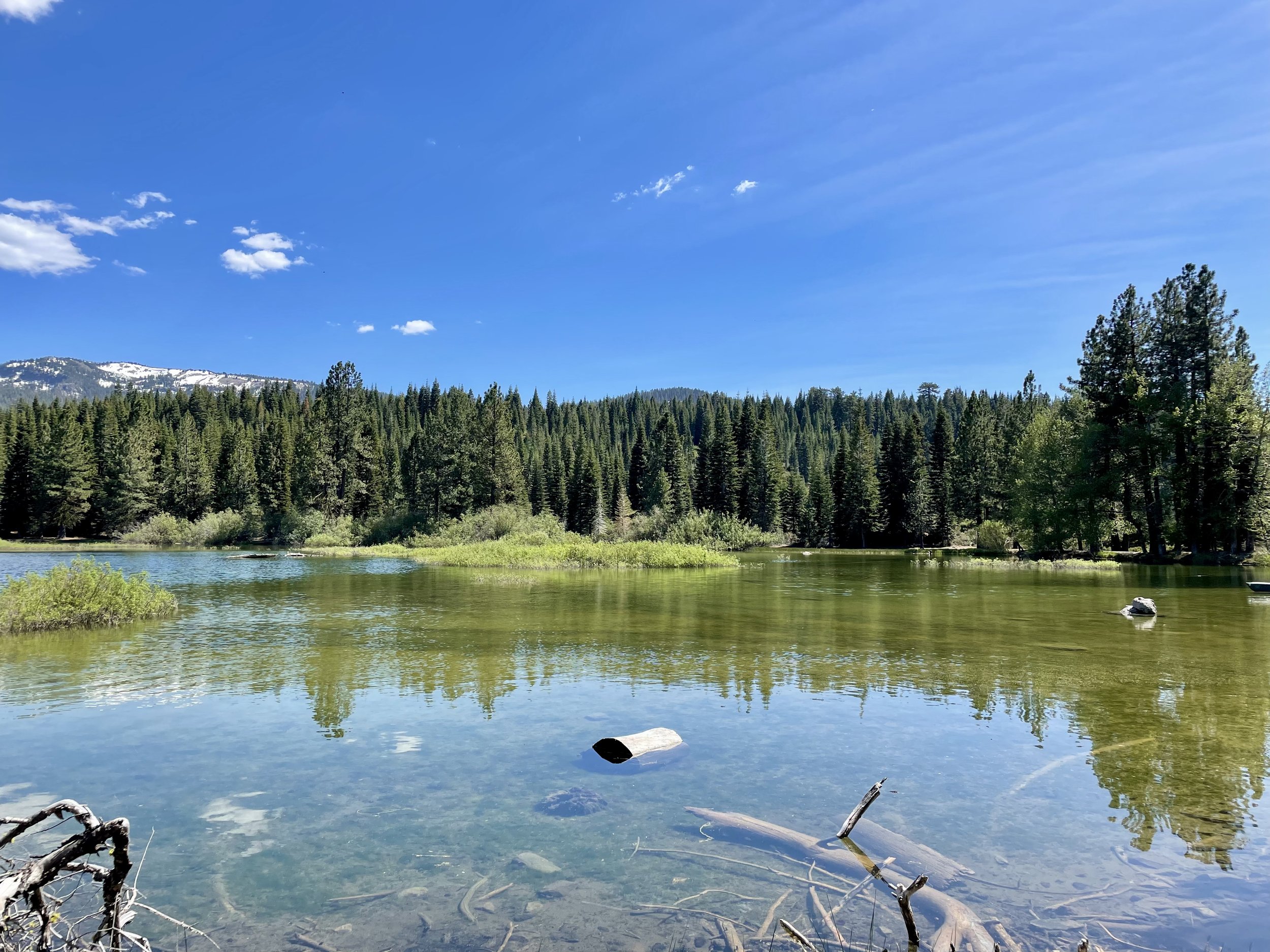
I left Pinecrest on June 28 and drove two hours to Yosemite National Park, which I haven’t been to since I was in high school. It was a beautiful and sunny day and I enjoyed the views along California SR-120 on my drive, also known as Tioga Pass. Since I always get the America Is Beautiful National Parks Pass every year, I was able to secure a day pass for Yosemite as the park does require reservations from April to October. Driving into Yosemite Valley, a glacier carved valley in the western Sierra Nevada mountain range, you promptly get surrounded by towering granite summits and a dense forest of pines, with well-known landmarks gracing your vision. The valley is drained by the Merced River and a multitude of streams and waterfalls flow into it, including Tenaya, Illilouette, Yosemite and Bridalveil Creeks. I took my time driving around the loop through the valley, stopping at various spots to immerse myself in the spectacular views.

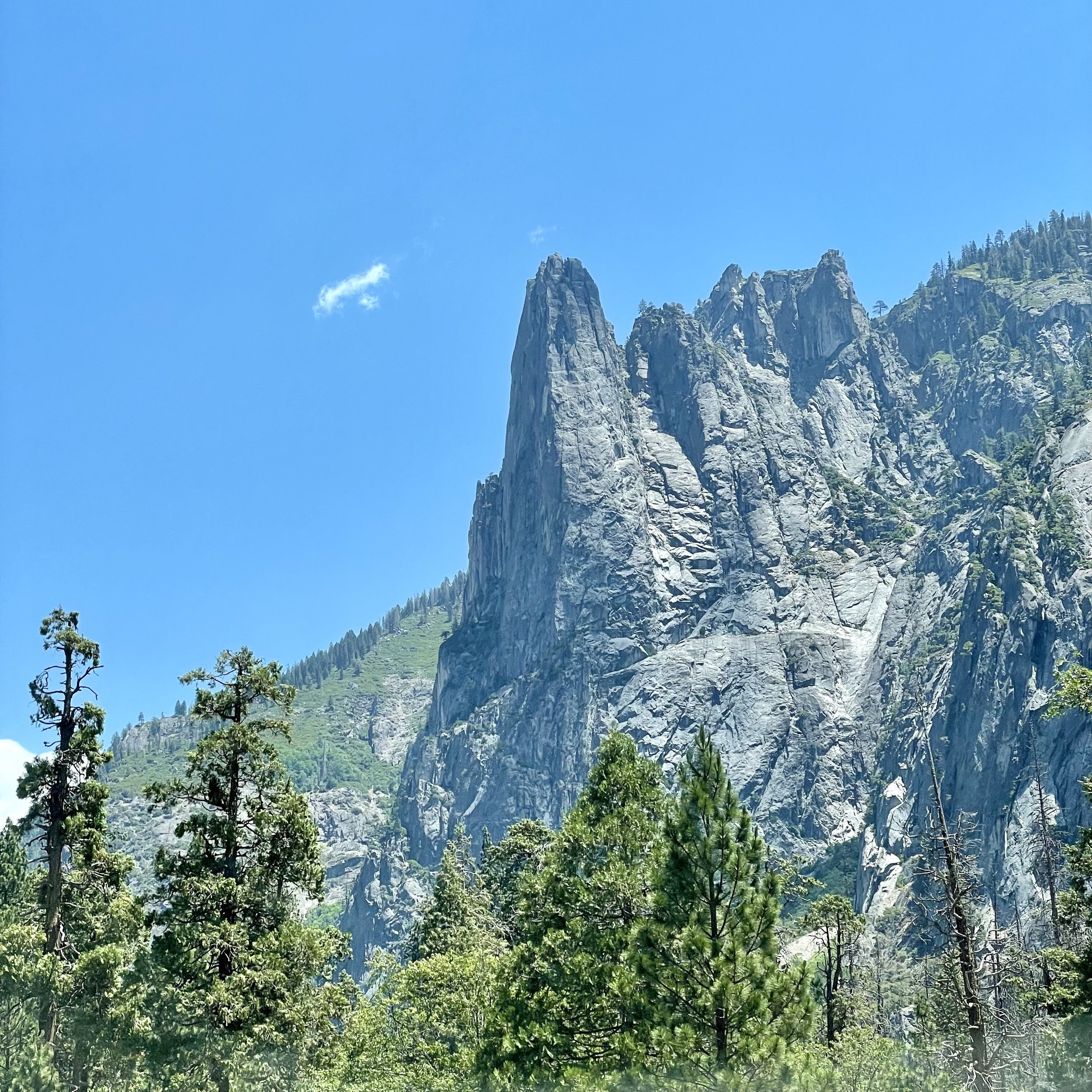
Upon entering the valley, you immediately get hit by undeniable presence of El Capitan, a granite monolith that's about 3,000 feet (914 m) from base to summit along its tallest face. El Capitan is composed almost entirely of a pale, coarse-grained granite approximately 100 MYA (million years old) and is a world-famous location for big wall climbing, including the disciplines of aid climbing, free climbing, and more recently for free solo climbing. El Capitán ("the captain", "the chief") was taken to be a loose Spanish translation of the local Native American name for the cliff,.“

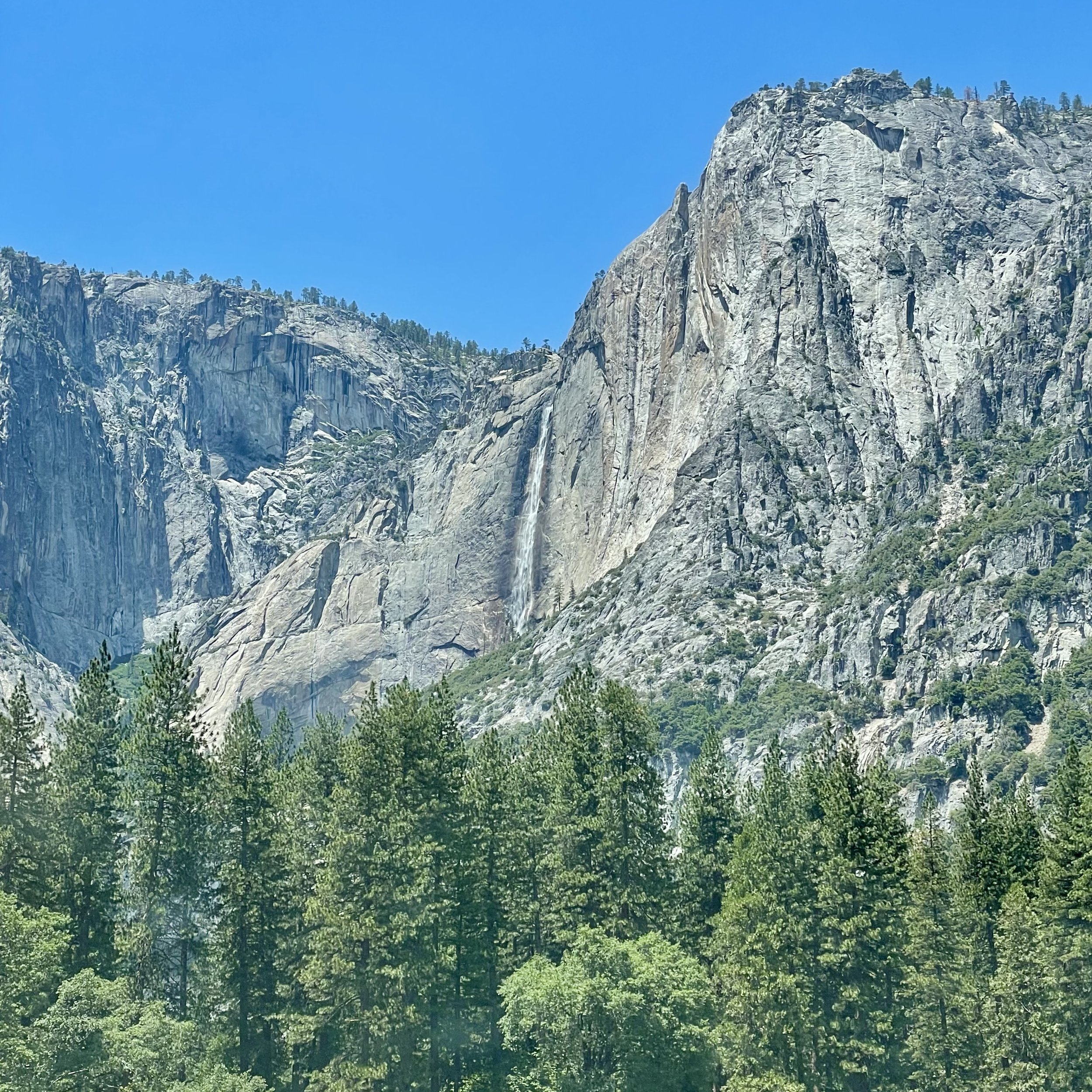
My next incredible view was of Yosemite Falls, the highest waterfall in North America, dropping a total of 2,425 feet (739 m) from the top of the upper fall to the base of the lower fall. Yosemite Falls is actually made up of three separate falls: Upper Yosemite Fall (1,430 feet), the Middle Cascades (675 feet), and Lower Yosemite Fall (320 feet). When I was 15, I hiked the falls to the halfway point with my high school adventure club. I’m not in hiking shape anymore, so I enjoyed the view from the valley floor, happy that the water flow is at its peak in the Spring. The Ahwahneechee people, the native people of Yosemite Valley, called the waterfall "Cholock" ("the fall") and believed that the plunge pool at its base was inhabited by the spirits of several witches, called the "Poloti.

At the end of the valley loop is the famed rock formation of Half Dome, a batholith named for its distinct shape. One side is a sheer face while the other three sides are smooth and round, making it appear like a dome cut in half. It stands at nearly 8,800 feet above sea level and is composed of quartz monzonite, an igneous rock that solidified several thousand feet within the Earth. At its core are the remains of a magma chamber that cooled slowly and crystallized beneath the Earth's surface, which was then exposed and cut in half by erosion, leading to its current shape. Originally named “Tis-sa-ack,” an Ahwahnechee phrase for Cleft Rock, Half Dome has been the home to many famous ascents, including the first known ascent by George Anderson in 1875, who drilled holes into the smooth granite to scale the rock’s face.

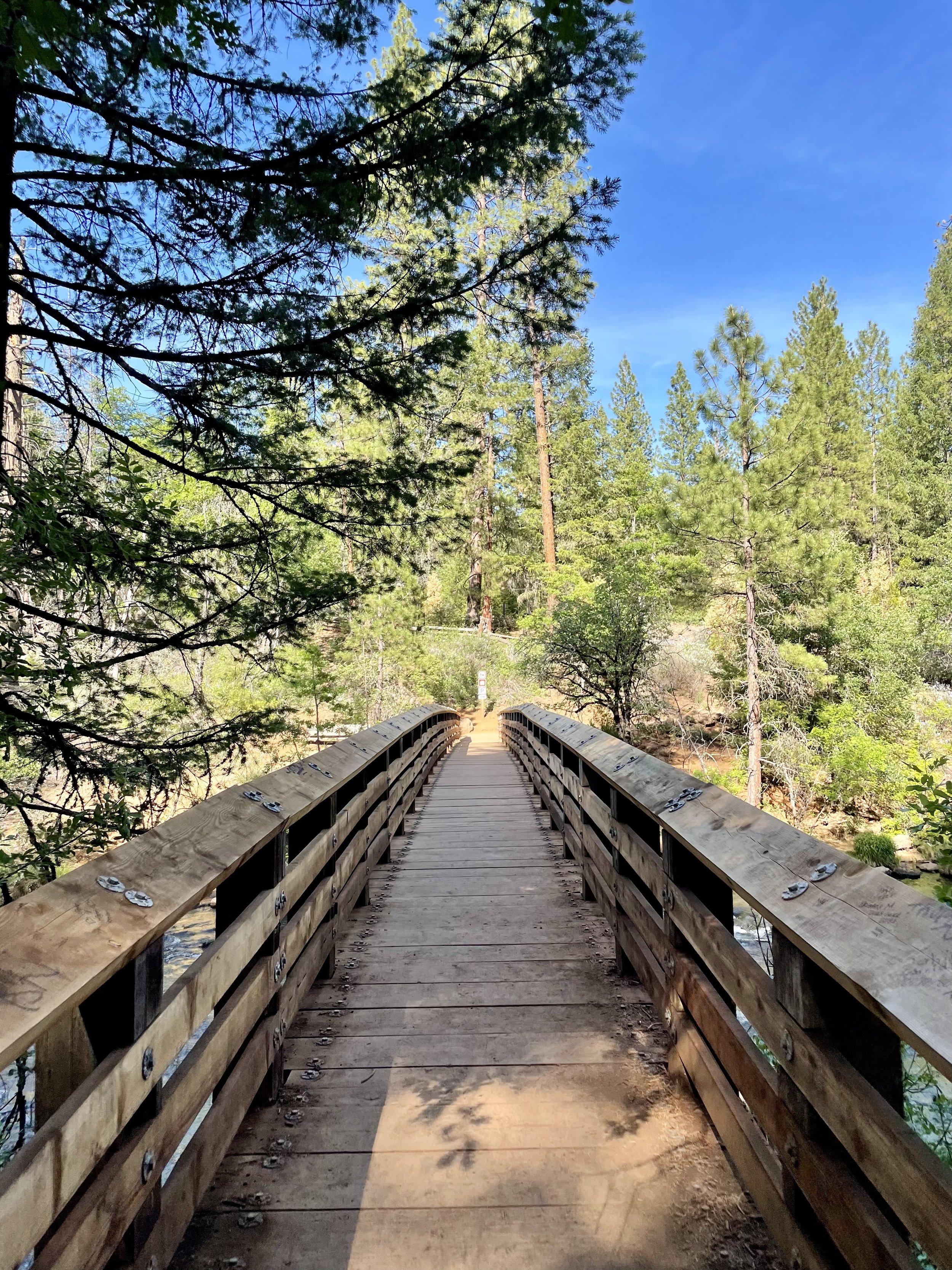
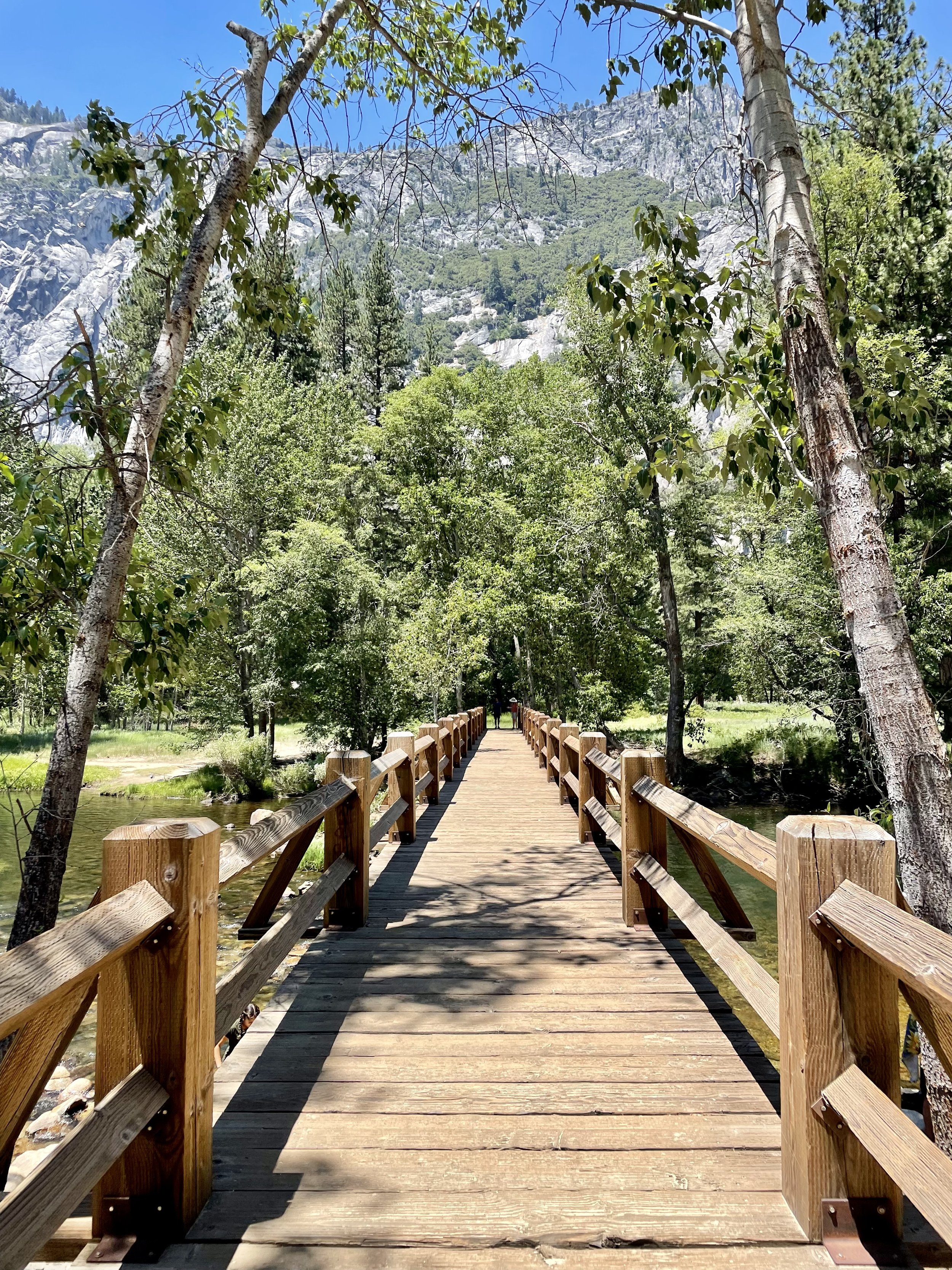
It was such a beautiful day that I made a few stops along the Merced River to walk the trail. The Merced River first formed as the Sierra Nevada rose about 10 million years ago, and sediment eroded from its canyon helped form the flat floor of the San Joaquin Valley. Glaciation during the ice ages carved the high elevation parts of the watershed, including Yosemite Valley, into their present shape. Many Native American tribes have lived on the Merced River including the Miwok, Paiute, and Ahwahneechee. In the early 19th century, military expeditions sent by Spanish colonists from coastal California traveled into the Central Valley, and on one of these trips, headed by lieutenant Gabriel Moraga, the colonists arrived on the south bank of the Merced River thirsty and low on provisions. They named the river Rio de Nuestra Señora de la Merced (River of Our Lady of Mercy) because it provided much needed water. I definitely recommend walking around, checking out the Superintendent's Bridge, the Sentinel Bridge, and other bridges to take in all the views, and even taking a dip into the river while you’re visiting.

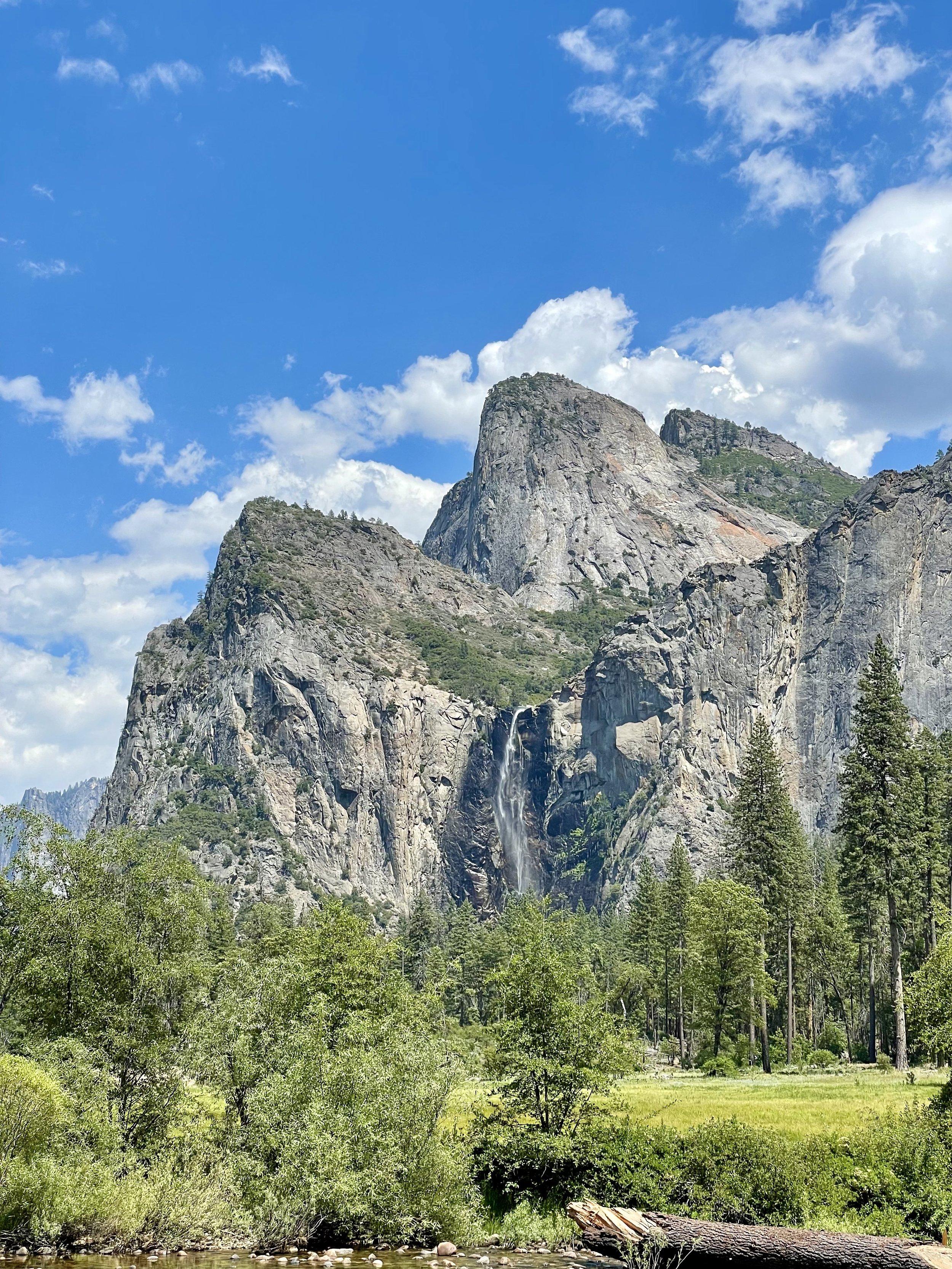
Another unforgettable view is that of Bridalveil Fall, which is 617 ft (188 m) in height and flows year round. While most of the falls in Yosemite are spawned by the glacier carved hanging valleys pouring the waterways into steep cascades, the primary source of Bridalveil Fall is Ostrander Lake, some 9.9 miles (16 km) to the south. In a brisk wind, the falling water is often blown sideways, and when the flow is light, it may not reach the ground directly below. Because of this, the Ahwahneechee Native Americans called this waterfall "Pohono", which means "Spirit of the Puffing Wind". As you can see in my photos, the wind definitely blew the top of the fall like a fan while the rest cascaded down the rocks to the bottom.

Since I entered the park through the north entrance, I didn’t experience the spectacular Tunnel View until I worked my way out on the south end, stopping at the vista point east of the Wawona Tunnel portal. The area was full of tourists taking in the view that Ansel Adams made famous. Luckily I found a parking spot and joined my fellow sightseers in capturing this unforgettable view of Yosemite Valley that features the southwest face of El Capitan on the left, Half Dome on axis, and Bridalveil Fall on the right.

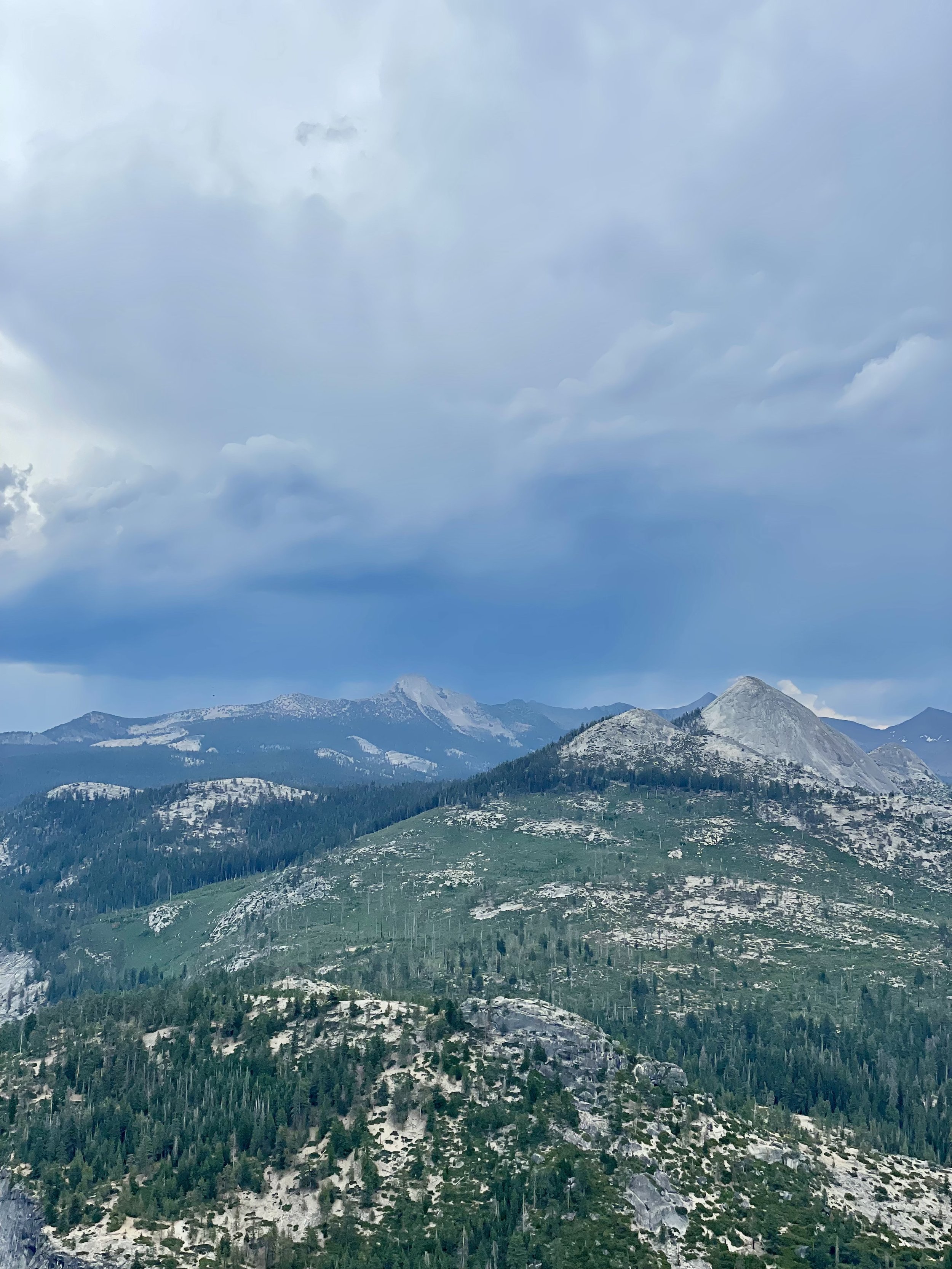
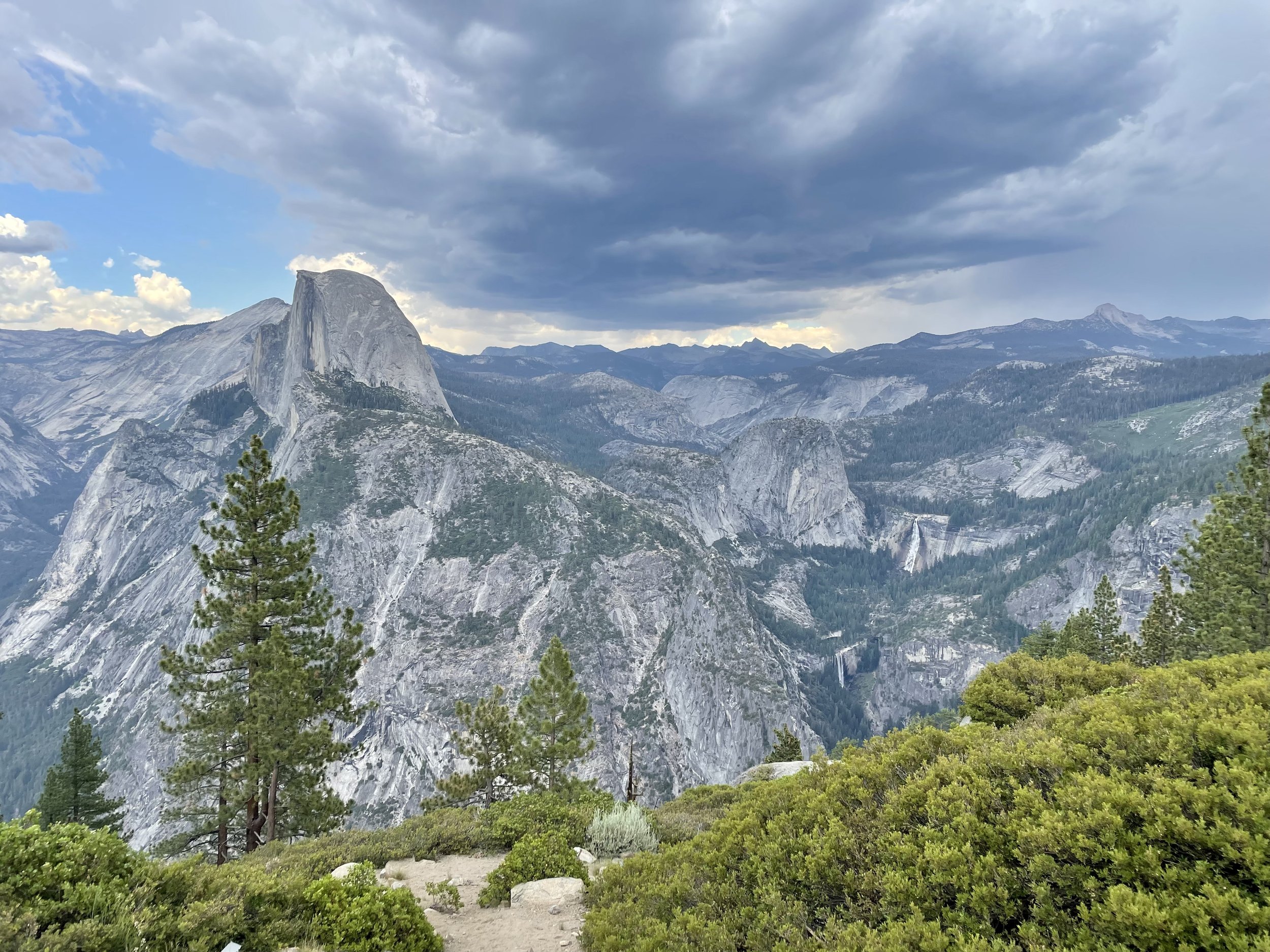
Next up was driving up the south wall to check out the overlooks with commanding views of the valley below via Glacier Point Road. My first stop was Washburn Point where one has the perfect side angle view of Half Dome, without seeing any of its face, as well as the stunning view of the “giant staircase,” the cliff wall containing Nevada Fall and Vernal Fall, with Mount Broderick and Liberty Cap watching over the falls. The afternoon clouds were turning a bit moody in shades blue and gray, lending an ominous feel to the landscape, with hints of sunny clouds in the distance. It almost felt like there was a storm brewing, casting a shadow over the panoramic view.

Then I headed to Glacier Point, a world-renowned overlook that gives visitors a grand view of the valley from above and a captivating vista of the park's southeastern high peaks. Glacier Point is located on the south wall of Yosemite Valley at an elevation of 7,214 feet (2,199 m). I recommend walking the whole viewpoint to get different glimpses of all the sights, including a more angled view of Half Dome with its face, as well as the giant staircase of falls, and Clouds Rest, a massive granite formation just northeast of Half Dome.

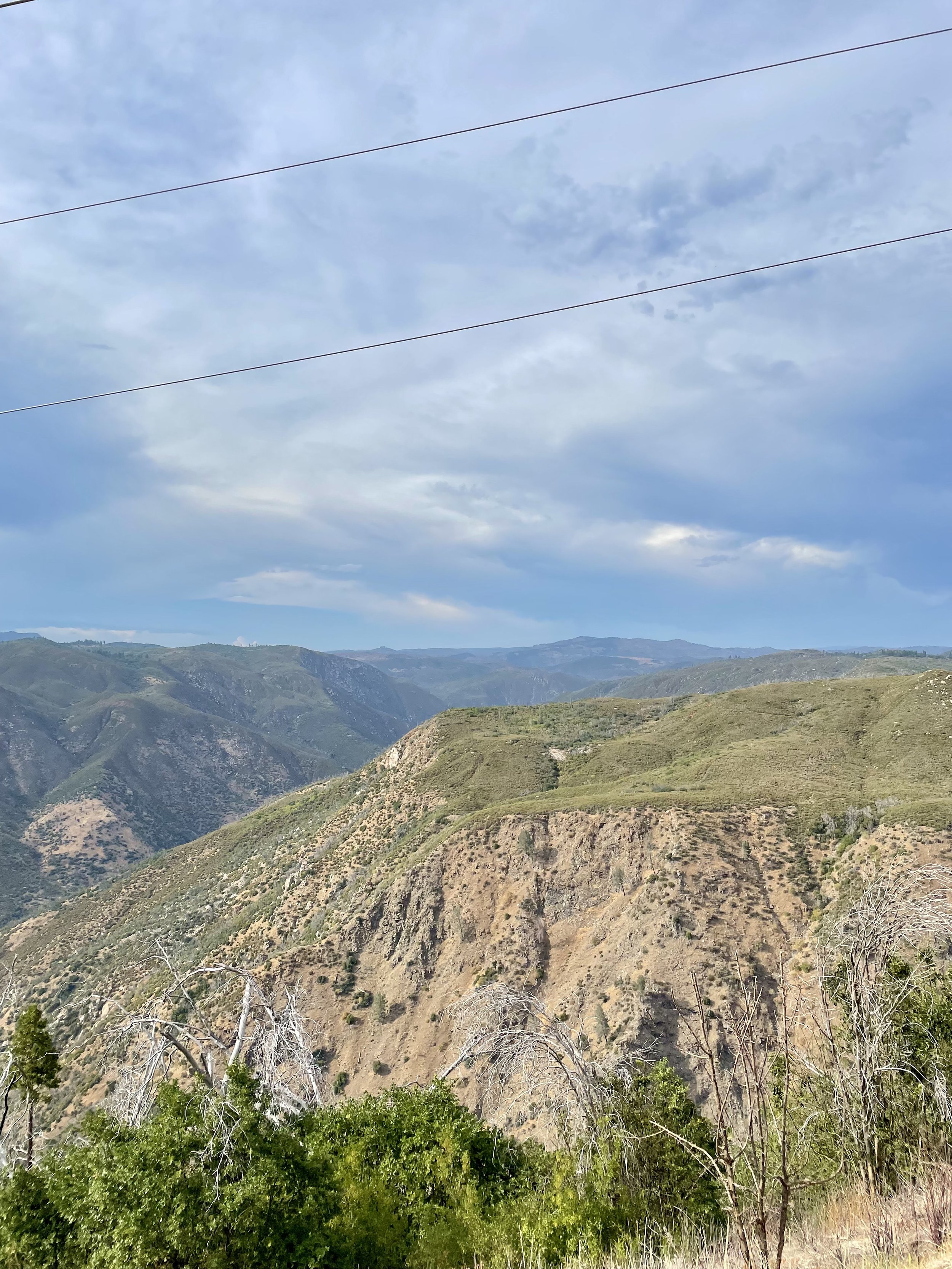
As I left Yosemite and drove east towards Groveland, I happened to drive by the Stanislaus National Forest vista point named “Rim of the World” so I stopped at the roadside pullout to take in the view. It overlooks the deep canyon of the Tuolumne River with the Sierra peaks in the distance, though the view is partially obstructed by power lines. It’s definitely worth pulling over to soak in a breath-taking, panoramic view, but you’ll also notice the scars of the devastation of the “Rim Fire,” a forest fire that hit the place in August 2013, the third-largest wildfire in California's recorded history and the largest recorded in the Sierra Nevada at the time.

Seeing Yosemite as an adult was beyond my expectations. It’s one of the most popular national parks with photos inundating the internet, but unless you experience it in person, you will never fully understand the awe and amazement of this incredible glacier carved wonder! Stay tuned for my next post about a ranch near Coulterville that’s available for hosting various events.

Comment

Comment

Lassen Volcanic Park, Manzanita Lake & Burney Falls

After my time at Descend on Lost Sierra, I headed north to Lassen Volcanic National Park on May 31, 2021. Did you know that Lassen Peak is the largest plug dome volcano in the world and the southernmost volcano in the Cascade Range? Lassen Volcanic National Park is also one of the few areas in the world where all four types of volcano can be found—plug dome, shield, cinder cone, and stratovolcano.

I enjoyed the drive through the volcanic landscape with hopes that I could hike the Bumpass Hell Trailhead and witness the largest hydrothermal area in the park. Sadly the trail was still closed due to the snow, making this the 2nd time I haven’t had the pleasure of seeing the 16 acres of boiling springs and mud pots, hissing steam vents, and roaring fumaroles up close! The first time I came to Lassen in 2018, this 3-mile roundtrip trail was closed for maintenance, so it looks like I’ll have to come back to Lassen again to conquer this trail and see the volcanic activity from the new boardwalks.

As you drive through this amazing national park from the Southwest entrance to Northwest entrance, you get stunning views of Mt Diller, Brokeoff Mountain, Eagle Peak, and Mt Lassen, as well as Reading Peak and Hat Mountain. The snow on the ground and the blue sky with some puffy clouds made for a great background really capturing the beauty of all these incredible peaks! I made it a point to stop at Emerald Lake and Lake Helen at the base of Lassen since these two icy lakes often reflect the mountain peaks and trees perfectly. Lake Helen is a glacial lake or a tarn occupying a cirque, an amphitheatre-like valley formed by glacial erosion, and its incredible blue color comes from the unique mineral content of the lake. Since the lake is at a high elevation at around 8,200 feet, the lake is frozen and covered in deep snow for most of the year from around October/November until July/August despite being over 100 feet deep. While Lake Helen is deep and blue, Emerald Lake gets its green color from vegetation that grows in its shallow waters. Some day I plan to hike the 5-mile hike to the top of Lassen Peak but I wasn’t eager to do it in snow that day.

I was excited to get to Manzanita Lake on the north end of the park as it’s one of my favorite lakes to hike around! This 1.6-mile trail around the lake has so many wonderful views that I took lots of photos to capture its beauty on this warm spring day with deep blue skies and some white puffy clouds. Manzanita Lake is one of the most photographed lakes in Lassen and the centerpiece of the park’s main visitor area. It’s also a great place to camp with 179 campsites near the lakefront. After my stroll around the lake, I took advantage of being the only one at the Chaos Crags viewpoint, another great place to stop in this amazing volcanic park. These crags formed as six dacite domes 1,100-1,000 years ago, one dome collapsing during an explosive eruption about 70 years later. The eruptions at the Chaos Crags mark one of just three instances of Holocene activity within the Lassen volcanic center.

My time in Lassen came to an end so I drove to one of my other favorite spots in Northern California and possibly the most beautiful waterfalls I’ve seen in my adult life — Burney Falls! Located in the McArthur-Burney Falls Memorial State Park, this 129-foot-tall, fern-draped cascade of water seems to come out of nowhere. The water comes from underground springs above and at the falls and provides an almost constant flow rate of 100 million gallons (379 million liters) per day, even during the dry summer months. It’s no wonder 26th President Teddy Roosevelt dubbed it “the eighth wonder of the world”! Every time I come here, I dip into the clear icy pool of water which never goes much above 42*F. Considering it was in the high-90’s that day, I really enjoyed the cold water and soaked in the incredible views. Burney Falls is an outstanding example of a waterfall and stream fed by large springs that are commonly associated with areas covered by recent lava flows, and also of a waterfall formed by the undercutting of horizontal rock layers. The soft white rock is diatomite and its presence is evidence that a very large lake once filled the region and supported abundant tiny freshwater plankton called diatoms. Interesting fact for you, the trail to Burney Falls that runs over Burney Creek also hits the Pacific Crest Trail.

Later that afternoon, I headed past the Lake Britton Bridge, the old railroad trestle shown in the 1986 movie “Stand By Me” and took a quick photo of the dilapidated trestle. The bridge was built in 1955 on the McCloud River Railroad, primarily a logging railroad. The steel bridge is 450 feet long and is about 75 feet above the waters of Lake Britton. The bridge has now been stripped of rails and is no long in use and there is a blockade placed in front to restrict access after a Reno man was killed jumping off the bridge. This part of the Burney branch was operational until 2005. I’ve always admired the water below and plan to camp along the northshore of Lake Britton at some point to enjoy paddling around this beautiful reservoir.

I have boondocked near the McCloud Falls on US Forest land a few years prior, so I headed there with the plan to spend the night nestled among the tall trees. As I was settling in, I noticed that the sky was turning into some great sunset colors, so I decided to chase the sunset instead and headed to Mt Shasta, stopping to capture the golden hour on the mountain. Instead of backtracking to McCloud, I decided to spend the night at the rest stop past Weed near the airport that night.

My next blog post is about Crater Lake National Park, which I went to the next morning!

Comment

Comment

The Trip That Changed My Life

As many of you know, I decided to pack up my life in California back in Fall of 2020 and move to the Pacific Northwest. I had been wanting to move out of California for awhile, mainly because I didn’t love the heat and traffic, but I was so established there between friendships, work, and my house that moving seemed like a lot of work and a little scary. I always heard that once you move out of California, it’s hard to move back, especially if you sell your house. Then in August 2020, Silicon Valley was hit with a huge dry lightning storm that caused some of the biggest fires in California history. For two weeks we had an orange apocalyptic sky with bad AQI that ended up affecting the whole West Coast, with smoke moving across the whole country! Between the fires and the increased amount of summer days over 100*F, I was over the heat and smoke, so I went on a 5 week road trip to Oregon and Washington to see where I would want to live.

For some reason, I never made it to the PNW until 2016, despite living in California most of my life. The guy I was dating that year took me on a vanlife road trip to Oregon and Washington, which is when I discovered how much I liked those two states. I kept visiting and exploring them over the next few years in my RV and enjoying my time there, making them viable choices of where to live next. I also considered moving to the Central Coast of California, somewhere near Pismo Beach. I went on this month-long road trip with another female vanlifer named Cory whom I met at a few vanlife gatherings over the years. She also wanted to leave the Bay Area and move to the PNW. We started the journey on September 24th and worked out way north to Fort Braggg, through the various Redwoods in Northern California, and even stopped at Moonstone Beach.

I originally figured I’d find the perfect beach town in Oregon as I’ve always wanted to live by water. Brookings was a front runner prior to the trip, mainly due to being right at the California border and having a lot of sunny days compared to other oceanside towns. One concern I had though was health care in these small beach towns as they don’t have the same amenities as big cities, which aren’t exactly that close. I did enjoy my time in Harbor and Brookings, but there was a heatwave hitting California and Southern Oregon with 90+* temps that made me reconsider the idea of moving to a place that was still quite hot at the beginning of Fall. I also heard from some newer locals I met who had moved there that finding a house was hard since not much inventory was available. One family had been looking for a year and still hadn’t found a house that was worthwhile. Cory and I decided to drive further north to get away from the heat and continue to see what towns were more favorable.

After a nice stint on the Oregon coast with stops in Bandon, Florence, Coos Bay, Yachats, Newport, Tillamook, Manzanita (another town that topped my list), and Astoria, we worked out way inland along the Columbia River Gorge on the Washington side to Skamokawa for riverside camping, and then even further inland to Graham where Cory had some friends that hosted us with a gorgeous view of Mount Rainier. From there we headed to Alki Beach in West Seattle, but the weather turned gray and misty, plus we spent a restless night along the waterfront due to traffic and noise. Cory needed to get her Roadtrek serviced near Seattle for a few days, so we parted ways and I headed north to Bellingham to visit a friend from high school who always spoke very highly of this small city near the Canadian border.

What I didn’t realize at the time was how this part of the trip would change my life forever. I literally FELL IN LOVE WITH BELLINGHAM! I had the best four days exploring this idyllic bayside city that feels like a big town. There are no high rise buildings, no traffic, lots of parks, waterfront trails, a beautiful waterfall, and the huge 13 miles long Lake Whatcom only 10 minutes from downtown. The weather was sunny and between the bay, the lake, and the mountains, I just felt like I was home. Bellingham has a European feel to it and there are a lot of outdoor activities to enjoy without having to drive far. It’s a haven for hiking, kayaking, paddle-boarding, boating, fishing, mountain biking, and even skiing and snowboarding at Mount Baker. I also took a day trip to Anacortes, which is a charming island town close to the San Juan Islands, and Deception Pass State Park. I hired my friend’s real estate agent with hopes of finding a house with lake or sunset view in the Bellingham vicinity before I left.

After my incredible days in Bellingham, Cory and I met up again and headed south to Bay View State Park for some camping, meeting up with another vanlifer whom I met on Instagram named Cameron. Then after a stop at Snoqualmie Falls, the three of us headed to the Olympic Peninsula to spend a few days in Sequim, known for its lavender, game farm, and lots of water and mountain views. Sequim is a small town of 30K people (if you count the greater surrounding area) and is often referred to as the “Blue Hole” because it is in the rain shadow of the Olympic Mountains and stays sunnier than most of the Puget Sound area. There are still some occasional drizzles of rain, but those led to seeing lots of rainbows!! Cory and I met with a real estate agent and got familiar with the different regions of Sequim and I even found a house on sale that appealed to me. I made an offer on it, but was beaten by a much higher cash offer. Turns out one of the founders of Descend on Bend lives in Sequim, so I spent one night at their place enjoying the sunset view and bonding with the family. My days in Sequim were quite lovely, making it my second choice to move to.

Cameron, Cory, and I parted ways after Sequim. Cameron headed to spend time with a friend of his in Port Angeles, Cory headed to Oregon’s wine country, and I headed further west and then south on the Olympic Peninsula to explore Lake Crescent, Marymere Falls, and the Hoh Rainforest, all of which are located in the Olympic National Park. It was a wet and rainy few days, therefore, I headed back inland to McMinnville, Oregon, for some wine tasting in sunny warm temps. From there, I worked my way south with a stop in Corvallis for cider tasting, and then west to Highway 101 to take the scenic, mostly ocean-front drive south with quite a few stops in the Samuel H Boardman Scenic Corridor just north of Brookings. The moment I crossed the border and saw the “Welcome to California” sign, my heart sank, which is when I knew the time for me to move was official — I no longer wanted to live in California.

I got home on October 30, 2020, and packed up the 10% of my belongings I wanted to keep in 2 weeks. I had an estate sale on November 21st. The following week I had friends and acquaintances take whatever they wanted from what was left, and then the weekend after Thanksgiving, I made a Craigslist post for people to grab whatever they wanted from the garage. I had very little left for donation and dump runs, and then my house was cleaned, staged, photographed, and went on the MLS on December 4th. I had so many offers the following day that I went under contract on the 5th. That’s how quick the process was, a little over a month and I no longer owned property in California! The crazy part was that I hadn’t found a house yet in Bellingham nor Sequim, so I started looking for a rental and found one just outside of Bellingham. Then the day after I closed escrow on my California house, this beautiful modern house near Lake Whatcom in Bellingham went on the market. It was everything I ever I wanted style wise, so I bid on it sight unseen, though my Bellingham friend did go look at it for me and gave me his approval. The sellers didn’t want a bidding war so they took my offer and I went under contract with a mid-February close. I was able to stay in the California house I just sold until January 21st, then I stayed at my friend’s ranch until I moved to Washington on February 1, 2021.

That Pacific Northwest vanlife trip was the best decision of my life. Many of my Bay Area friends didn’t understand my urge to pack up and move in such a short time frame, but for me it was the right decision. I just had a gut feeling that I needed to start over somewhere fresh with a healthier lifestyle. Was it a bold move with some risk involved? SURE! But I also knew that if by chance I didn’t love living in Bellingham, I could always move after two years and find another place. I also knew to trust my instincts and they told me that living in Washington was just what I needed. My instincts were right! Turns out I absolutely love where I live, that the Pacific Northwest climate, landscape, scenery, and lifestyle really suit me, and I’ve never looked back. Sometimes I even wish that I moved here when I was younger because I feel so at home now.

I always encourage everyone to FOLLOW YOUR DREAMS. Moving can be scary, especially when you’ve lived somewhere most of your life, but moving can also be SO REWARDING! I can honestly say I live a much healthier lifestyle, enjoying nature, exploring new places, camping, hiking, kayaking, spending time outdoors, all things I was not doing in California. The heat and the traffic kept me from exploring and made me lethargic. I can no longer imagine living in a big city. I finally live near water like I’ve always wanted, I even live in the forest. Plus I love that I can be completely immersed in nature feeling like I’m far from civilization within 5 minutes of my house. So if you’re reading this and you’ve been feeling the need to change your life, I encourage you to go for it, even if it seems scary or impossible. You are the the only person that can change your quality of life and make it better. JUST DO IT, take the plunge!

A quick closing note. Cory also ended up finding her retirement place on this caravanning trip. She moved to Florence, OR, about a year after I moved. She’s also super happy with her decision!

Comment

Comment

Muir Beach Overlook

MuirBeachOverlook.jpg

Muir Beach Overlook is part of the Golden Gate National Recreation Area, just south of Stinson Beach on Highway 1 and north of the Golden Gate Bridge. Not only does this cliffside park have some beautiful sweeping views of the Pacific Ocean and the coastline, but it also provides a glimpse into our wartime history.

Muir Beach Overlook contains several historic base-end stations. From these stations, soldiers viewed ships and triangulated the distance, speed, and direction of these ships in coordination with different stations. These stations were mostly important for artillery units stationed on the coast to attack any invasion. They gained particular importance during World War II immediately after the bombing of Pearl Harbor when many in California feared San Francisco or Los Angeles would be the next target. These stations became obsolete when radar technology took over. A few of them remain open like ruins where you may enter them to get somewhat of a perspective of the soldiers who were stationed there.

On clear days you can see San Francisco but there was a little bit of cloud cover so I could only see the Sutro Tower in the distance (photo 7). You also get a slight view of Muir Beach (photo 3) and you can see the top of Mount Tamalpais (photo 4, top right peak). The last photo is the large scale tactile topographic model which I thought was quite cool! It’s a beautiful place to visit with an iconic staircase that leads to the small overlook on the cliff. I highly recommend it if you’re ever in the area!

Check out my Instagram post for more pics!

Comment

Comment

Fort Bragg & Ocean Views

FortBragg.jpg

I enjoyed a lovely lunch with beach front views in Fort Bragg last week after a wonderful camping experience in the Timber Cove area. Despite the foggy weather along most of the coast, there was a nice patch of blue skies in Fort Bragg with the fog layer over the ocean.

As I drove off from Ocean Cove earlier that morning, I took some photos looking back at the beautiful campground on the cliff. The pics I took don’t so it justice but it gives you an idea of how cool the place is.

I always love it when you come around a bend and see the beautiful California coastline, so I couldn’t help taking pics whilst I was driving.

See my Instagram post for all these photos!

Comment

Comment

Highway 1 North Of San Francisco

BodegaBay.jpg

I never drove the stretch of Highway 1 north of San Francisco to Fort Bragg myself, so I decided to get away from the heatwave and enjoy the coast for a few days.

It was a bit foggy once I got to the coast, but since I dislike being too hot, the change to cooler weather was much appreciated. I stopped at a small turnout after driving through Bodega Bay to eat lunch and enjoy the ocean view.

It’s a nice feeling to take photos of my beautiful van in picturesque settings. I especially love all the Cypress trees along the coast. These trees have always struck me as beautiful since they grow in harsh conditions on cliffs and fog, plus I love how they form their canopy structure with the wind.

Did you know that there are 11 species of cypress that occur in California? Sadly 7 of these have been assigned a California Rare Plant Rank of 1B (rare, threatened, or endangered). These include Santa Cruz, Tecate, Gowen, Monterey, Piute, Pygmy, and Cuyamaca cypress varietals. One of the main reasons for this is climate change and human-induced changes to the natural fire regime. If the interval between fires is too short, trees are unable to reach reproductive age before the next fire, often causing cypress to be replaced by adjacent vegetation types. Thanks to California Native Plant Society for this info.

For more photos, check out my Instagram post!

Comment

1 Comment

First Van Trip Was A Success!

Pinecrest.jpg

First van trip was a success! I went to Pinecrest Lake with my friends and enjoyed the fact that I didn’t have to set up a tent, canopy, air mattress, etc. I parked on fairly level ground and got situated quickly!

I used my induction stove for the first time that night. At first I was getting an error message and had to figure out what it was without having internet. Figured out that you have to have your pan on the stove for it to make the magnetic connection before it will turn on. It’s a smart safety feature, but since I forgot my manuals at home, it took me a few minutes to figure out.

I slept well in the van. I fit perfectly from head to toe and the bed is very comfortable. I cut a queen fitted sheet so it fits the u-shape bed in order to keep the upholstery from getting all furry and dirty from my cat Maverick. I generally sleep hot, but with the windows open and the cooler nights, I was perfect with just a blanket.

Maverick did really well in the van. He got comfortable quickly, laying on my lap on the drive up (as he usually does), then laying on the counter and induction stove so he could look out the sliding door. He also loves hiding on the drivers seat under the zebra table, which I had swiveled to the right of the kitchen counter for additional surface area.

I had the screens up and they worked great for keeping the bugs out and making Mav feel safe inside. That extra barrier gives my cat the feeling that he’s protected from the noise and people outside.

On the third day, I accidentally overloaded my lithium ion battery. Since I was parked under trees, my battery wasn’t getting a full charge from the solar. When I went to cook, I forgot to turn off the fan which was on high. Between the fridge, the fan, the water heater, and the stove, I had too many appliances draining the battery so it shut down. But with a quick charge from the engine, I got it back online.

Overall, I learned a lot on how I use the space and where everything should go. I love the placement of the fridge as I can easily get drinks while standing outside the door. Swiveling the seats in is very convenient as it opens up the space. I love my van!

For more photos, check out my Instagram post!

1 Comment